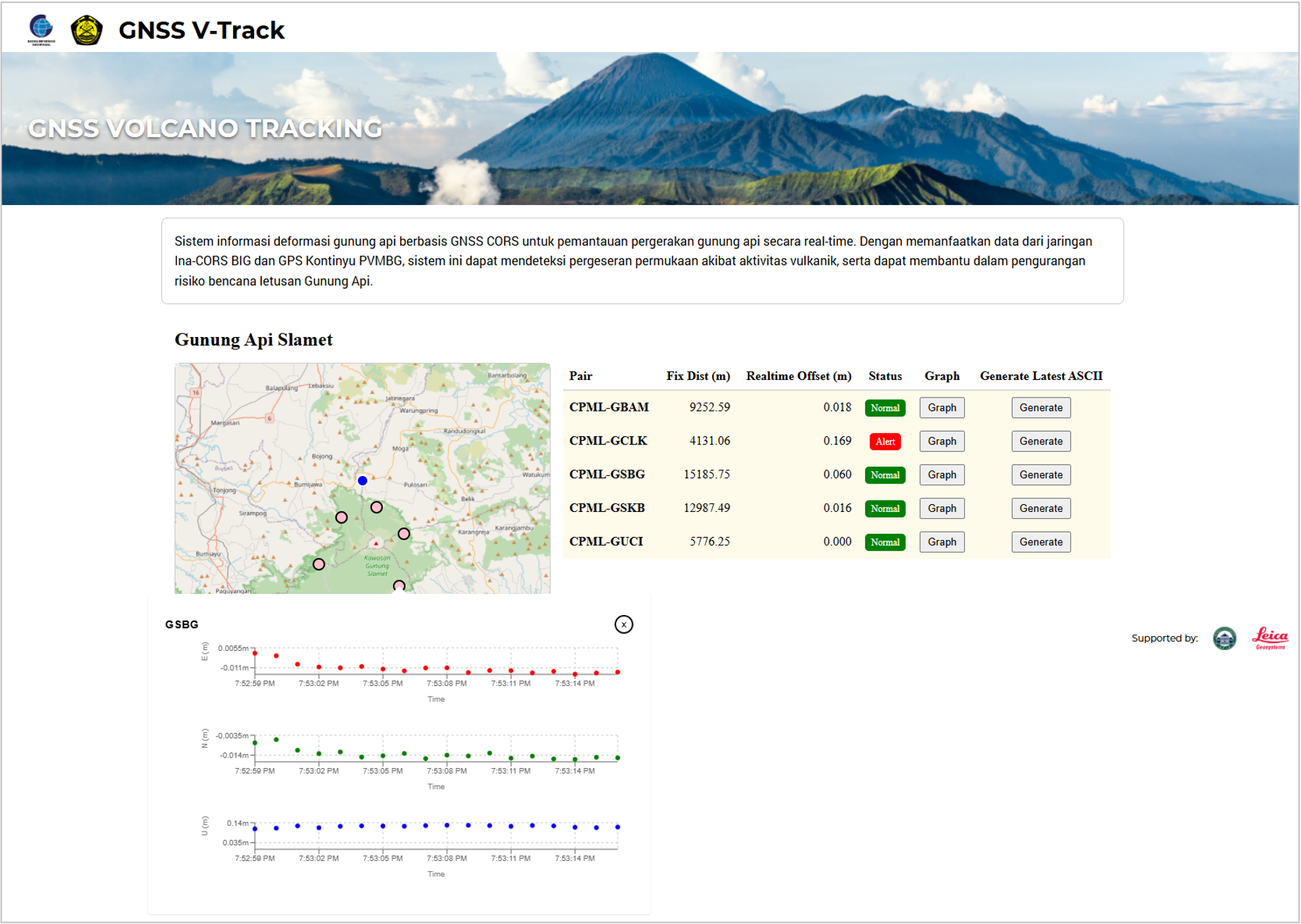
GNSS Realtime Volcano Monitoring
Volcano deformation monitoring using realtime GNSS coordinate displacement calculations—supporting early warning, forecasting, and disaster risk reduction for active volcanoes.
Key Outcomes
Accurate, Explainable Displacement Analytics for Long-Term Monitoring
The system must produce precise computations, provide interpretable views for analysts, and manage long-running time series without sacrificing performance.
Standardized GNSS Processing + Analyst-Friendly Monitoring Experience
Sintesa delivered a repeatable processing pipeline with QA rules, efficient time-series APIs, and dashboards tailored to daily monitoring workflows.
Related Case Studies
Explore similar projects across our portfolio
Sistem Referensi Geospasial Indonesia (SRGI)
SRGI is a multi-discipline application which provide integrated portal for various spatial reference-related information. Use heavy spatial operations and calculations.
Collaborative Mapping Platform
Users can participate in global mapping, add point-of-interest interactively. Use by BIG, BNPB, KEMENDES, various communities for disaster response and community mapping.
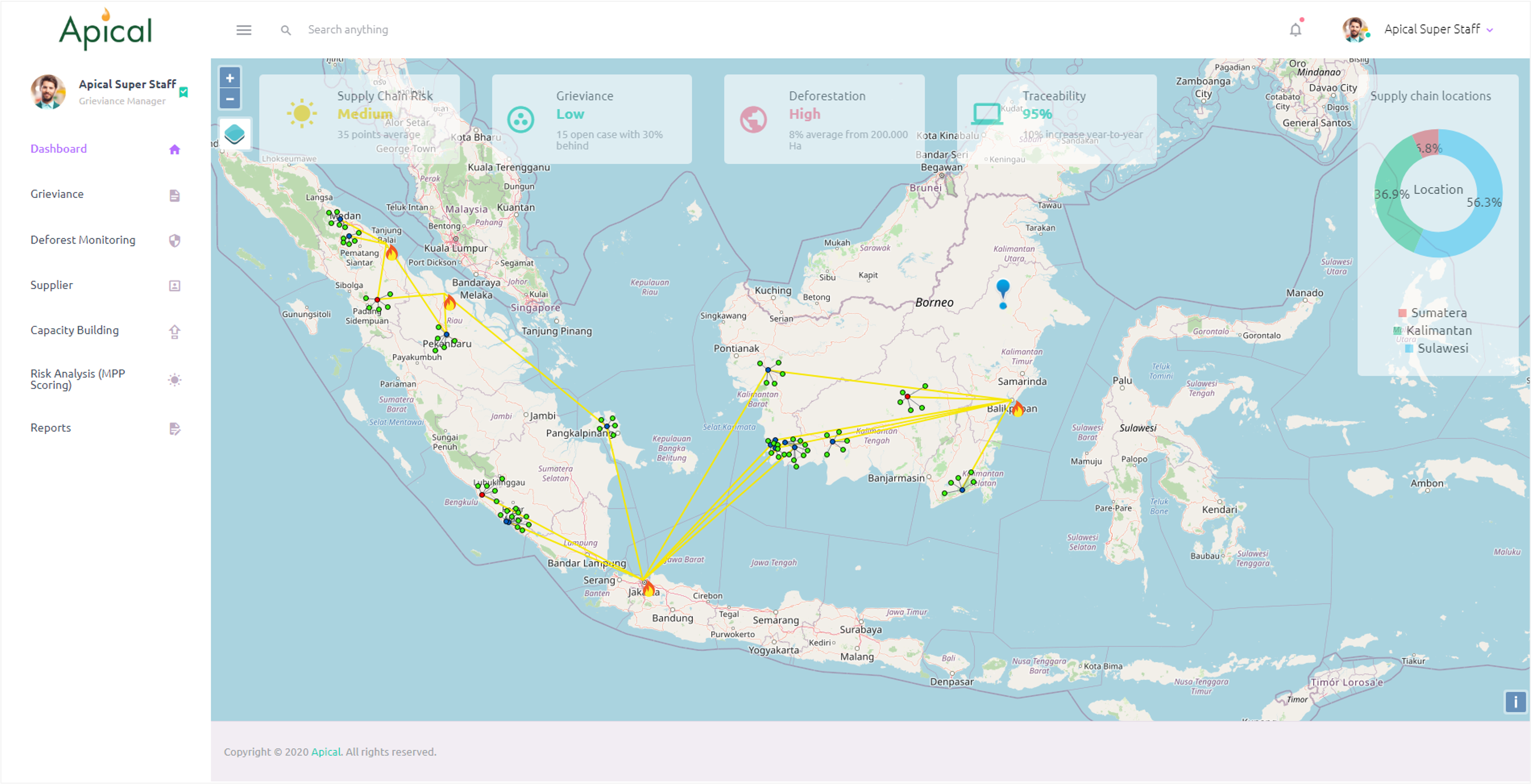
NDPE Management Platform
NDPE (No Deforestation, No Peat, No Exploitation) management platform for palm-oil supply chains—grievance handling, deforestation monitoring, supplier mapping, and traceability dashboards.
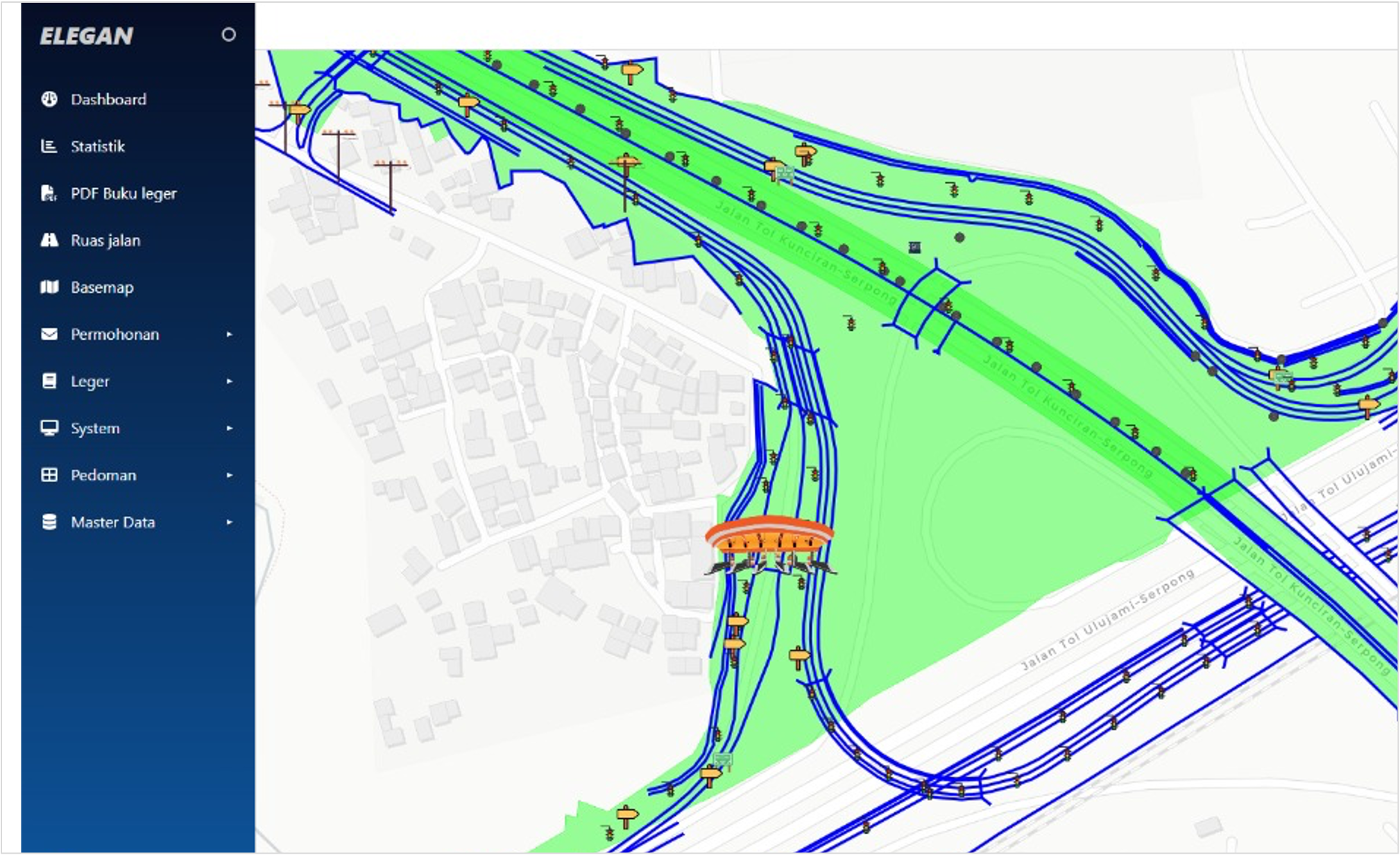
Elektronik Leger Jalan
Build solution for Kementrian PUPR to manage leger data. System features many endpoint access, and provide geospatial statistics for national road infrastructure.
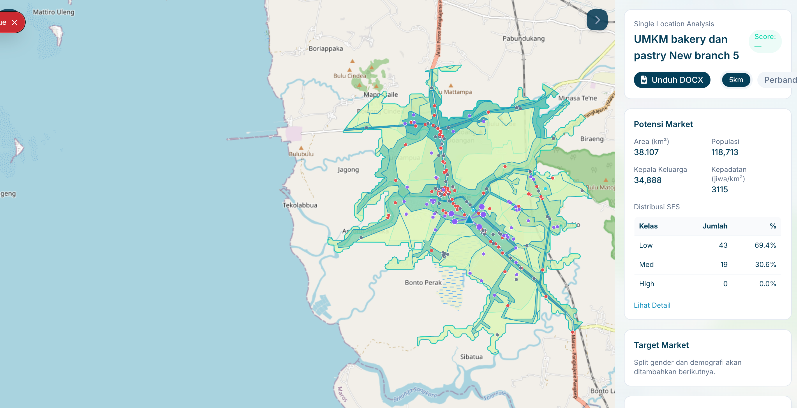
Location Intelligence
Delivered a map-first operations console for analysts and agencies to run location analyses, compare candidate sites, and export decision-ready outputs with documented performance targets.
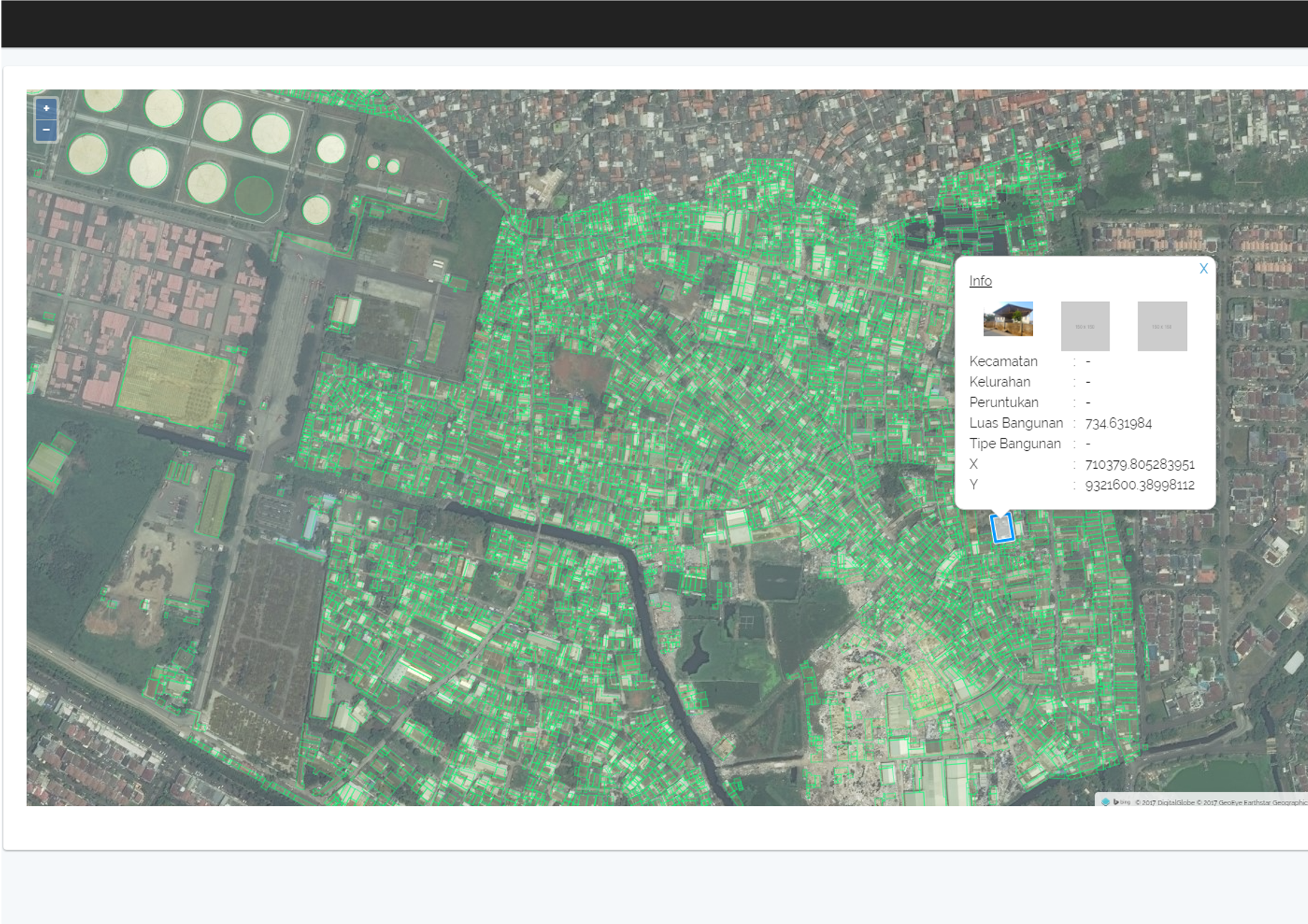
Depo Plumpang Mapping
Spatial map of depo plumpang for PT Pertamina. Layering data with custom information such as drone photos and 360 photos for comprehensive facility management.
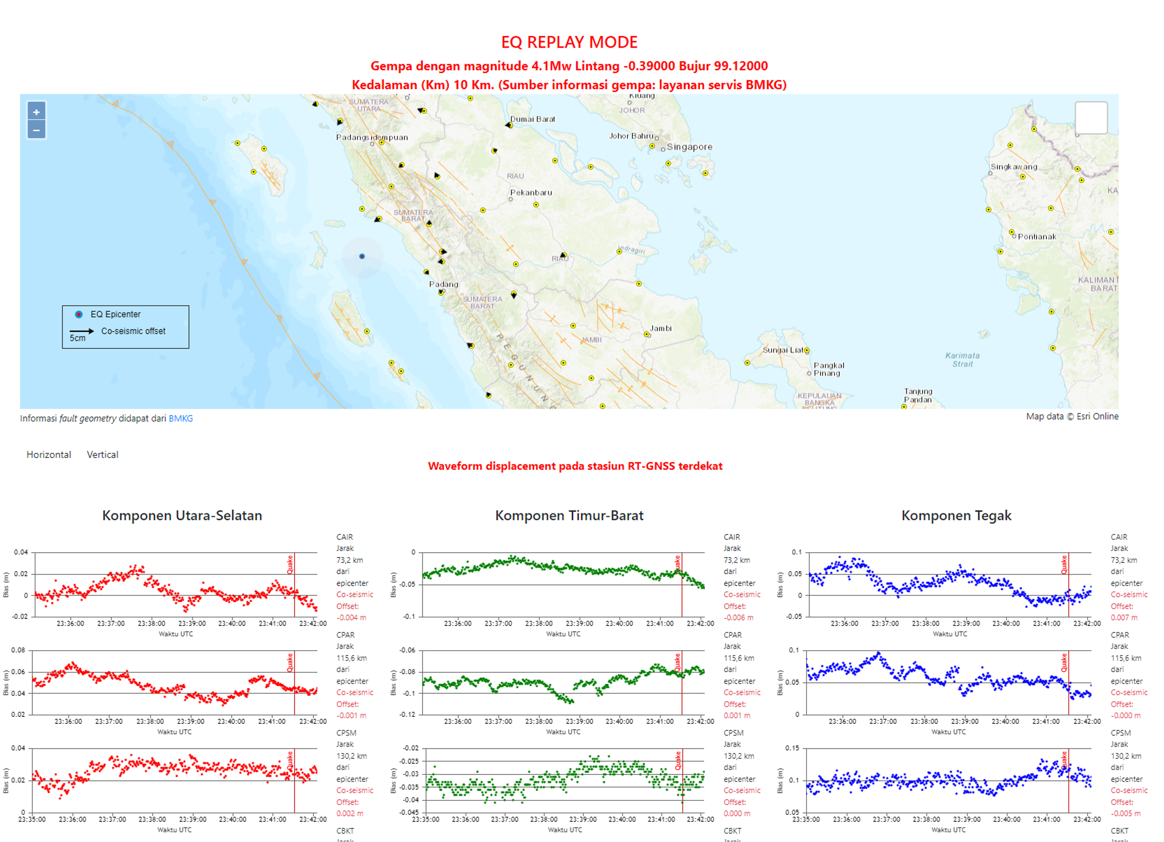
Earthquake GNSS Realtime Monitoring
Realtime earthquake replay and GNSS displacement monitoring—integrating seismic event data and station waveforms for rapid analysis and situational awareness.
Ready to Transform Your Operations?
Let’s discuss how our engineering expertise can deliver measurable results for your organization.